Dear Visitors:

Please scroll down the page to see present and archive blogs.

Thank you very much: Tramway Null(0)

Webrings - Maps - Trolleys and More

Navigation by WebRing.

Thursday, August 30, 2012

Terrain Analysis with GRASS 6.4.1. Test at Smith-9th Street

Visibility Analysis at Smith-9th Street Station -  The pink X is the location of the Smith-9th Street Station and the Red Circle is the location of the Williamburgh Bank Building shown in the picture above.  The dark green areas are areas at street level that are visible from the station.

  In he map above, I added the street grid.  The green area (non-neon) is the area produced by GRASS 6.4.1. in the Terrain Analysis Mode - Visibility Option for the Smith-9th Street station (pink x).  The elevation that I gave for the station was 90 feet.  GRASS 6.4.1 studied the elevation file (neon green color) and calculated the visibility to street level of an observer from the Smith-9th Street elevated station on the F line.  Since I added a street grid, I was able to locate the location of the Williamburgh Saving Bank building which is the the large sandstone pointed building in the center of the picture above obtained from the web.  The bank is indicated by a red circle.  The red circle is near the edge of the green visibility area.   In the photograph above, you can see that it appears on the edge of the viewing area.  If you look above and follow the F train route to the south and west, you can see that the F train splits up (right triangle) near Prospect Park.  Notice that the green area ends at Prospect Park West.  The elevation is very high there and you can see why a person standing at Smith-9th Street station looking west on 9th Street could not see much beyond the park.  The Smith-9th Street is currently going under rehab and it would be interesting to see when the station opens if this analysis is accurate.

Wednesday, August 29, 2012

Calculating Visibility from the Smith-9th Street Station in Brooklyn using GRASS 6.4.1.

In the attached map, New York Subway station and lines were brought in to produce a map.  The street elevation level was added and GRASS 6.4.1 terrain analysis was conducted to produce the visibility to the street surface from the station itself, which is about 90 feet tall.   The x-y coordinate I used was 985286.93, 184579.87   The green area on the map shows the area, if buildings were not in the way, how far an observer will see the surface.  Of course, you can see much further than the green area if you are looking at tall buildings and other structures.  Notice that the visibility area is not circular because the surface has hills in it that would block the observer's view.


These pictures were taken off the web.  The top picture is serveral years old and shows a southbound R-46 F train approaching the Smith-9th Street after leaving the the tunnel at Carroll Street.  The second picture is also off the web and was taken from the same station and is facing north showing the Culver Viaduct declining into the Carroll Street Station.  Notice the buildings on the hill west of the viaduct.  The above picture shows the viaduct above the Gowanus Canal. The station is above the canal and runs to the right.  Notice that on the terrain analysis diagram, the hill in Carroll gardens is blocking the view of the surface (non green area) , just like in the photograph.

   In the map below, the same GRASS 6.4.1 procedure was run,  except that the range was expanded to 700,000 meters.  I do not know why the analysis stops in middle of the harbor.  The Smith-9th Street station is found on the map as a red X.

Tuesday, August 28, 2012

PCC 1029 at Church and McDonald Avenues in Brooklyn

Source:  Dave Pirmann Collection.  Joe Testagrose Photo from Dave's Rail Pix


  In that wonderful video dealing with Route 4 in Riga, we see many junctions, some of which a very complicated.  In the attached photo, we see a westbound Church Avenue car making  a turn onto McDonald Avenue for a short turn at the Kensington Loop near 16th Avenue.  This almost grand junction, at McDonald and Church Avenues is shown on one of my prior track maps of the Church Avenue Line. Since the Church Avenue line was the last publicly owned trolley in New York State to operate, it is possible that this complicated junction was the last one to operate in New York State as well.  A similar junction was found at the east end of the line.  Under the junction was what was called at that time the Independent Subway Church Avenue Station that was served by "D" trains between Coney Island and 205th Street in the Bronx.  At that time, the subway section of the line was never called the Culver Line.

Monday, August 27, 2012

GRASS 6.4.1 Predicted Correctly the Location of LIRR Bay Ridge Division

  In the first frame, I used GRASS 6.4.1  and a New York City Elevation shape file.  I then used the terrain analysis feature and use the DY derivative procedure.  The shadow of the LIRR Bay Ridge Divisio cut was visible. This is because raster elevation files are aerial photographs.  The LIRR Bay Ridge Division Cut is very narrow in some places.  In the second frame, I added a Rail Road shape file which shows open air rail road rights of way.  The Bay Ridge Divsion trackage as shown in the map using the RR shape file is correctly aligned by the DY land terrain analysis procedure.  This may be helpful for looking for forgotten rights of way.  By the way, the Culver Viaduct does not show up in the DY frame, I was wrong.


DY GRASS 6.4.1 land terrain analysis.  Subway shape file added after analysis.  LIRR cut is visible.

Below, same frame but RR shape file added.  The RR shape file shows outside railroads in yellow. Includes outside rapid transit trackage.

Friday, August 24, 2012

Spatial Analysis Experiment Using Elevations to Find Rapid Transit Lines

Elevation in feet
DXY
DYY
DYY
DY
Aspect
Slope Raster
Profile Curv.  Bay Ridge RR Circled
DX


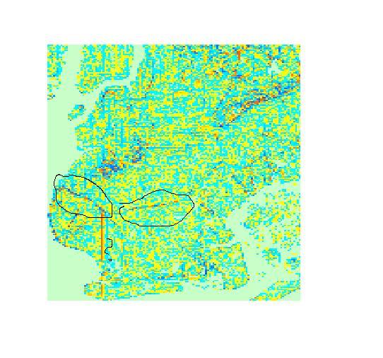
In the above experiment, I took the raster elevation file of New York City and I analyzed it using GRASS 6.4.1 under Terraine Analysis - Slope and Aspect option. I did not include any railroad or subway shape files.  GRASS 6.4.1 gives the option of producing maps analyzing the slope according to various derivatives and the results are shown above.  Although the resolution is not the best, you can make out various railroad cuts, such as the LIRR Bay Ridge Division Cut that runs from west to east in an arc.  You can see the shadows of various elevated lines, including the Culver Line as well.  Although not clear as posted, in the Red Hook area you can make out faintly the Culver Viaduct.  My guess is that if someone is trying to find the path of  a  past railroad or interurban or other railroad and the person has a good elevation file and a program similar to GRASS, the analyst can find the location of it using this or similar techniques if a good map is not available.  Notice the vertical line that approaches the Coney Island Creek and continues in Coney Island.  I do not believe that this is Cropsey Avenue and it may be some sort of computer error.
Tramway Null(0)
Shaded relief Analysis


Wednesday, August 22, 2012

F Train the New Silicon Subway?

Hi Folks:  Please see the attached article. The F train in Brooklyn covers part of the original Culver Line route.  Who would think that part of the Culver Line would become fashionable?  Map drawn by myself to show New York City neighborhoods connected by the F train in Brooklyn and Manhattan.  Shapefile is not of the latest routing.  Tramway Null(0)

http://www.crainsnewyork.com/article/20120729/REAL_ESTATE/307299984

15th Street Trolley Line in Park Slope and Red Hook Brooklyn

Source:  B. Linder, New York Division Bulletin, Vol. 20, No. 3, June 1977, pp. 6, 9.

The 15th Street Line was one of the lesser known streetcar lines in Brooklyn.  It started its' life as a Horse Car line in July 1888 from the historic transportation location of 9th Avenue and 20th Street to Hamilton Ferry.  The line was electricfied in 1893 and cetain cars ran from Hamilton Ferry to Coney Island via the West End right of way.  From 1899 to 1932, the line was extended to Coney Island via the Gravesend Avenue trolley line (McDonald Avenue) from 19th Street and 9th Avenue during various days in the summer season.  In 1929, the terminal was changed from Hamilton Ferry to Erie Basin via Richards Steet to Van Dyke Street.   The line was an early abandonment on November 8, 1941.  I believe this line never used PCC cars.  Historic routing information from Edward B. Watson in op. cit.