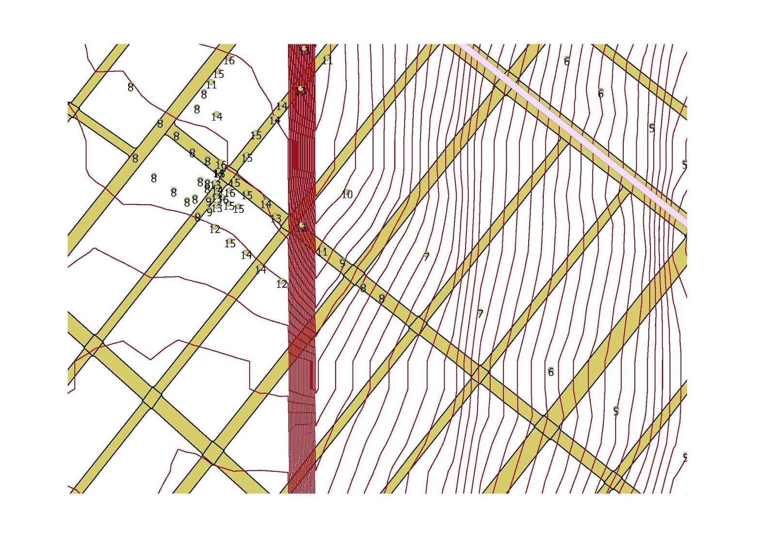
The map below was produced QGIS and includes the contour type elevation file for New York City. As shown in other posts, there appears to be a line at 90 degrees in the western part of Brooklyn. The above map is a close up and I incorporated the street grid and subway stops and lines. Notice that the red "error" line crosses close to the 20th Avenue and 86 Street station of the "D" train ( West End Line) in Brooklyn. Notice the group of contour lines to the right (east) of the red line. I cannot explain it. In the future, I will add the "add on" elevation feature to explore that area.
A street view in Google of the area reveals a relatively flat area.
In the map above, produced by QGIS, I used the plug in tool to assign an elevation at any selected point. Notice the cluster to the left of the red bar. It is at Bay 25th Street and Benson Avenue. Notice that the elevation changes from 8 feet to 15 feet on opposite sides of the intersection. The contour lines appear to be incorrect. On the right of the bar, there are many contour lines but the elevation does not change that much. Something is wrong here.


No comments:
Post a Comment