
Streetcars and Spatial Analysis. What are your proposals for streetcars and or trolleybuses in Brooklyn and New York City? Here past trackage maps are presented and analyzed in todays environment. Geospatial analytical methods are discussed regarding new routes.
Tuesday, April 23, 2013
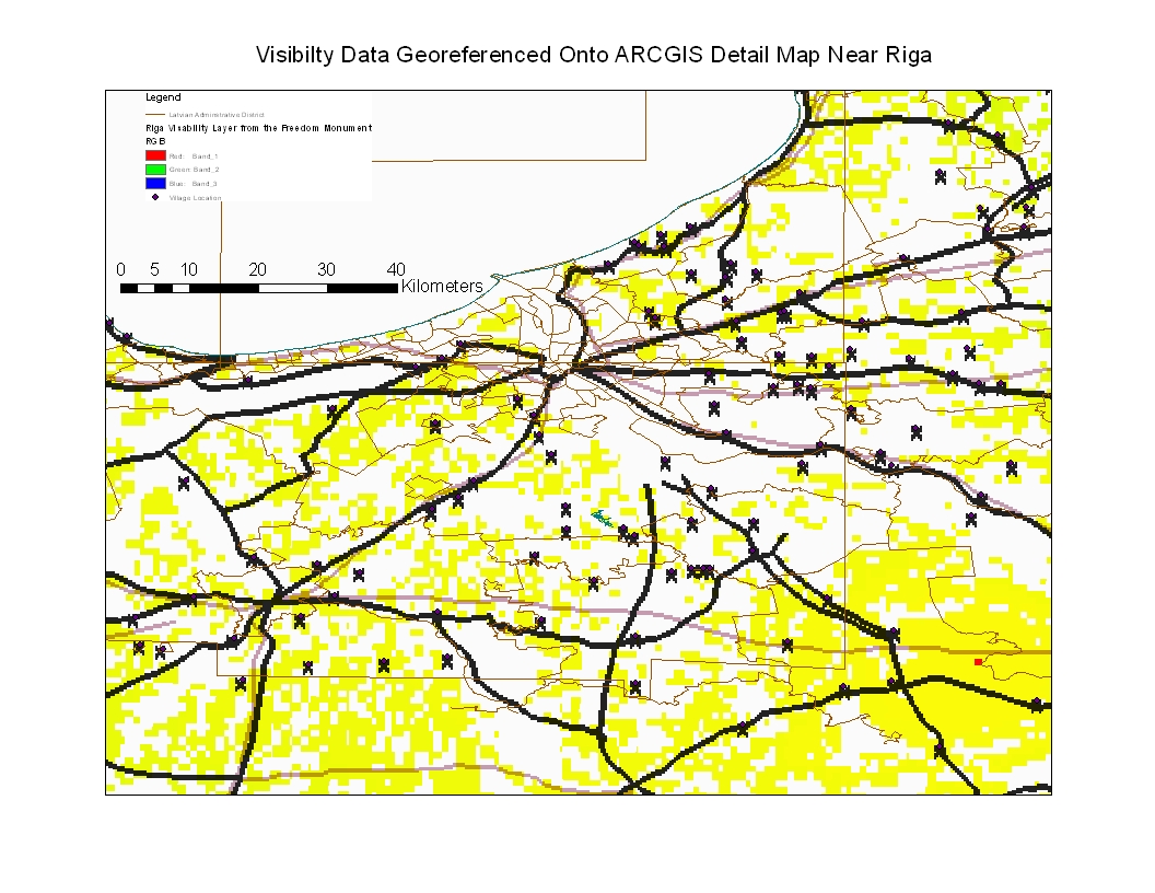
Riga Visibility Data Georeferenced Unto ARCGIS Riga Detail Map
In the map below, I took the visibility data from the Freedom Monument observation and georeferenced it to a more detailed ARCGIS map of the Riga region. The results indicate that the visibility detail is not so concentrated when georeferenced into a more detailed observation map. The yellow squares indicates that for the detail that is available, the visibility deta generated in GRASS 6.4.1 shows that the Riga region is relatively flat and that not considering buildings, visibility taking height into consideration from the top of the Freedom Monument is very great. The X's are villages, some of which was used for georeferencing. This is only an experiement, folks.

Subscribe to:
Post Comments (Atom)
No comments:
Post a Comment